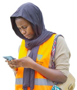
Our Story
GeoICT4e is grounded on the long-term and well-established cooperation between University of Turku (UTU) and the four Tanzanian Higher Education Institutions (HEIs) (UDSM, ARU, SUA, SUZA). It focuses on expanding the teaching and learning impacts from the previous institutional cooperation together with three added partners: TURKU UAS and Novia UAS from Finland, and MoCU from Tanzania.
Today, we have grown to a large eight-university consortium that enables development and institutional delivery of innovative and scalable geospatial and ICT e-learning services for Tanzanian HEI students, and beyond. Since our consortium goals are targeting for substantially broader learning impacts than before, we work in close cooperation with the local innovation and entrepreneur ecosystem and government sector actors, and the World Bank -funded by Tanzania Resilience Academy. We participate local communities through citizen panels to our challenge campaigns and create public awareness for inclusive and informed decision-making in Tanzania.
About GeoICT4e
Background
Geospatial-ICT technologies are making an impact leap due to globally accessible digital solutions. We are witnessing a massive growth of innovations built on open geospatial data through affordable mobile technologies, and these are tackling major challenges, such as rapid urbanization, degradation of marine and land environments, and humanitarian crises. The number of experts needed is growing, but also the required skills, capabilities and attitudes are changing. New generation HEI graduates need to be competent with the novel technologies, but equally they need to master the interface between technologies’ potential and societies’ emerging needs, working in a multi-stakeholder environment creating innovative and impact-based solutions.
Multicompetence Learning (MCL)
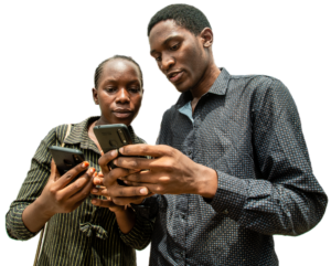
The central vehicle for education transformation in GeoICT4e is the students’ multicompetence learning (MCL) process, which happens via co-creative challenge campaigns organized in close cooperation with the innovation ecosystem actors and problem owners. This methodology enables the HEIs to catalyze a change, which we identify as ‘socially innovative geospatial and ICT education transformation’.
Aims
- Competent teaching and research staff with up-to-date geospatial and ICT skills, capable of tackling socio-ecological challenges in Tanzania
- Improved teaching contents and methods as well as effectively used GIS/ICT research facilities
- Increased synergies and interdependence among partner universities, their stakeholders and societal uses of their skills and resources
- Diverse collaboration by the HEIs with the public, private and civil society actors: catalyzing GIS/ICT business ecosystem development and providing skilled graduates for the private sector.
The essential elements of our MCL approach
Problem domain skills in space and time
Students are solving real, complex problems of the surrounding society and thus they need to understand the root causes and consequences of the problems and their spatial and temporal dimensions.
Geospatial data and technology skills
Students need to obtain skills in collecting and using digital geospatial data and open-source Geo-ICT technologies in a novel manner. Digital data is a key asset for creating solutions to complex problems.
Entrepreneurial and innovation skills
Students’ abilities and professional confidence evolve in multi-stakeholder teams so that they know how to approach real-word challenges in a contextually clever manner, working for problem-owners towards innovative and influential solutions.
Climate, sustainability and resilience skills
Global change is creating uncertainty and unpredictability to our socio-ecological systems. Students need to have skills to design climate-smart and resource-efficient solutions for social, environmental and economic sustainability and improved resilience.

2020 - 2021
Inception Phase
2021 -2022
Challenge 1 – 2 UDSM, ARU
On going Mini-MOOC development
2022 - 2023
Challenge 3 – 4 SA, SUZA
2023 - 2024
Challenge 5 MoCU
2024
Closeout phase
Universities
Benefited Experts
Learning Programmes
Project Coordinators

Prof. Niina Käyhkö
Department of Geography and Geology, University of Turku
Dr. Abubakar Diwani Bakari
Department of Computer Science and IT, State University of Zanzibar
Dr. George Matto
Department of Information and Communication Technology (ICT), Moshi Co-operative University
Dr. Ernest Mauya
Department of Forest Engineering and Wood Sciences, Sokoine University of Agriculture
Dr. Mercy Mbise
College of Information and Communication Technologies (CoICT), University of Dar es salaam
Dr. Zakaria Ngereja
Department of Geospatial Sciences and Technology, Ardhi University
Romi Rancken
Department of Bioeconomy, Novia University of Applied Sciences