The highly anticipated launching event of the Multicompetence Learning Challenge (MCL2.0), also known as MCL2023, took place today at Ardhi University...
Added in 1 year ago
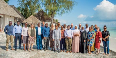
Reflections on the 2022 Multi-Competence Learning (MCL) campaigns and designing the 2023 MCL
The GeoICT4e family gathered together in Tanzania in November 2022 to discuss the Multi-Competence Learning (MCL) campaigns that were run in five Tanz...
Added in 2 years ago
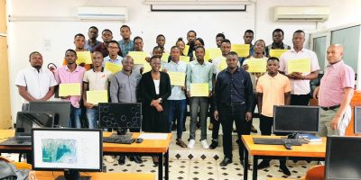
GEOICT4e concludes 8 weeks of the Multi competence Challenge Learning Program
As part of the implementation of the GEOICT4e project with the objective of Social innovations in Geo-ICT education at Tanzanian HEIs for improved emp...
Added in 2 years ago
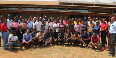
MULTICOMPETENCE LEARNING PROGRAM AT ARDHI UNIVERSITY FOCUSES ON SOLID WASTE MANAGEMENT CHALLENGE
On the 18th of July 2022, Prof. John Lupala the Deputy Vice Chancellor for Academic, Research, and Consultancy officiated the Multicompetence Learning...
Added in 2 years ago
Multi-Competence Learning (MCL) campaigns kick-off in Tanzania
Last minute preparations, revision of the mentors’ manual, polishing the e-learning platforms, organizing students and we are ready to go! Long-waited...